Machame Route: Kilimanjaro's Most Popular Climb
The Machame Route, affectionately known as the "Whiskey Route," is the most popular path to the summit of Mount Kilimanjaro. It earned its reputation for good reason: Machame combines diverse and spectacular scenery with a strong acclimatization profile, manageable daily distances, and an exciting variety of terrain - including the famous Barranco Wall scramble.
Approximately 40% of all Kilimanjaro climbers choose the Machame Route. On the recommended 7-day itinerary, success rates reach approximately 85%, making it one of the most reliable routes on the mountain.
Route Overview
| Detail | Information |
|---|---|
| Starting Gate | Machame Gate (1,800m) |
| Summit Approach | Via Barafu Camp |
| Descent | Mweka Route |
| Duration | 6-7 days (7 recommended) |
| Distance | ~62 km |
| Accommodation | Tent camping only |
| Difficulty | Moderate to challenging |
| Scenery | Excellent - diverse zones |
| Traffic | High during peak season |
| Success Rate | 73% (6-day), 85% (7-day) |
Day-by-Day Itinerary (7 Days)
Day 1: Machame Gate (1,800m) to Machame Camp (3,020m)
Distance: 11 km | Hiking Time: 5-7 hours | Elevation Gain: 1,220m
The trek begins at Machame Gate in the lush rainforest zone. After registering with the park authorities, you enter a world of towering trees, hanging mosses, and the sounds of unseen birds. The trail climbs steadily through the forest on a well-worn path that can be muddy, especially in the mornings. You may spot black-and-white colobus monkeys swinging through the canopy overhead. The first camp sits at the upper edge of the forest, where the trees begin to thin.
Day 2: Machame Camp (3,020m) to Shira Camp (3,840m)
Distance: 5 km | Hiking Time: 4-6 hours | Elevation Gain: 820m
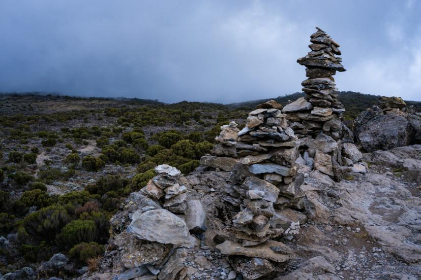
Leaving the forest behind, the trail crosses into the heath and moorland zone. The vegetation transforms into giant heather, wild flowers, and the distinctive giant groundsels unique to East African high mountains. The terrain becomes rockier and the views open dramatically. On clear days, Mount Meru rises on the western horizon. Shira Camp sits on the vast Shira Plateau, one of Kilimanjaro's most atmospheric camping spots.
Day 3: Shira Camp (3,840m) to Lava Tower (4,630m) to Barranco Camp (3,960m)
Distance: 10 km | Hiking Time: 6-8 hours | Elevation Gain/Loss: +790m / -670m
This is the critical acclimatization day. The route ascends to Lava Tower at 4,630 metres - a massive volcanic rock formation where many climbers first feel the effects of altitude. After lunch near the tower, you descend steeply to Barranco Camp at 3,960 metres. This "walk high, sleep low" approach is one of the most effective acclimatization strategies on the mountain. The descent into the Barranco Valley reveals stunning views of the Western Breach and the glaciers above.
Day 4: Barranco Camp (3,960m) to Karanga Camp (4,035m)
Distance: 5 km | Hiking Time: 4-5 hours | Elevation Gain: 75m (net)
The day begins with the highlight of the entire Machame Route: the Barranco Wall. This 257-metre rock face looks daunting from below, but the route up is a hands-on scramble rather than a technical climb. Your guides will assist at the steeper sections, and the views from the top are extraordinary. After the wall, the trail undulates through the Karanga Valley to camp. This is the last water point before the summit push.
Day 5: Karanga Camp (4,035m) to Barafu Camp (4,673m)
Distance: 4 km | Hiking Time: 3-4 hours | Elevation Gain: 638m
A shorter day designed to conserve energy for summit night. The trail crosses rocky terrain in the alpine desert zone to reach Barafu Camp, which sits on a barren, exposed ridge. "Barafu" means "ice" in Swahili, and the camp lives up to its name - nights here are bitterly cold and windy. You arrive by early afternoon, eat an early dinner, and attempt to sleep before the midnight wake-up call.
Day 6: Barafu Camp (4,673m) to Uhuru Peak (5,895m) to Mweka Camp (3,100m)
Distance: 13 km | Hiking Time: 12-16 hours total | Elevation Gain/Loss: +1,222m / -2,795m
Summit day. You wake around midnight, eat a light breakfast, and begin the climb in darkness. The first hours are spent on steep, loose scree, zigzagging upward by headlamp. The cold is intense - temperatures between -15°C and -25°C with wind chill. After approximately 6-7 hours, you reach Stella Point (5,756m) on the crater rim, where the first light of dawn reveals the glaciers. From Stella Point, it is another 45 minutes to one hour along the crater rim to Uhuru Peak (5,895m). After summit photos and a moment of celebration, you begin the long descent - back to Barafu for rest and food, then continuing down to Mweka Camp in the forest zone.
Day 7: Mweka Camp (3,100m) to Mweka Gate (1,640m)
Distance: 10 km | Hiking Time: 3-4 hours | Elevation Loss: 1,460m
The final descent through the rainforest to Mweka Gate, where your vehicle is waiting. The trail can be slippery, and trekking poles are invaluable. At the gate, you receive your summit certificate (a green certificate for Uhuru Peak, a brown certificate for Stella Point) and say goodbye to your crew. Transfer back to your hotel in Moshi.
Why Choose Machame
Scenery variety: No other popular route matches Machame for landscape diversity. You trek through rainforest, moorland, alpine desert, and the Barranco Wall scramble - all before the summit push.
Good acclimatization: The Lava Tower acclimatization day (walk high, sleep low) is highly effective and is a major reason for the strong success rate.
The Barranco Wall: For many climbers, this is the most memorable part of the entire trek. It adds a sense of adventure that other routes lack.
Established infrastructure: As the most popular route, camps are well-maintained, trail conditions are monitored regularly, and guides know every metre of the path.
What to Consider
No hut accommodation: Machame is tent camping only. If you prefer huts, the Marangu Route is your only option.
Crowds during peak season: July and August see the highest traffic. Consider September-October or January-February for a quieter experience.
Physically demanding: The daily elevation gains and the Barranco Wall require good fitness. See our fitness guide for preparation advice.
Descent via Mweka: Machame is not a loop - you descend via the Mweka Route on the southeastern side. This is standard for most routes and means you see different scenery on the way down.